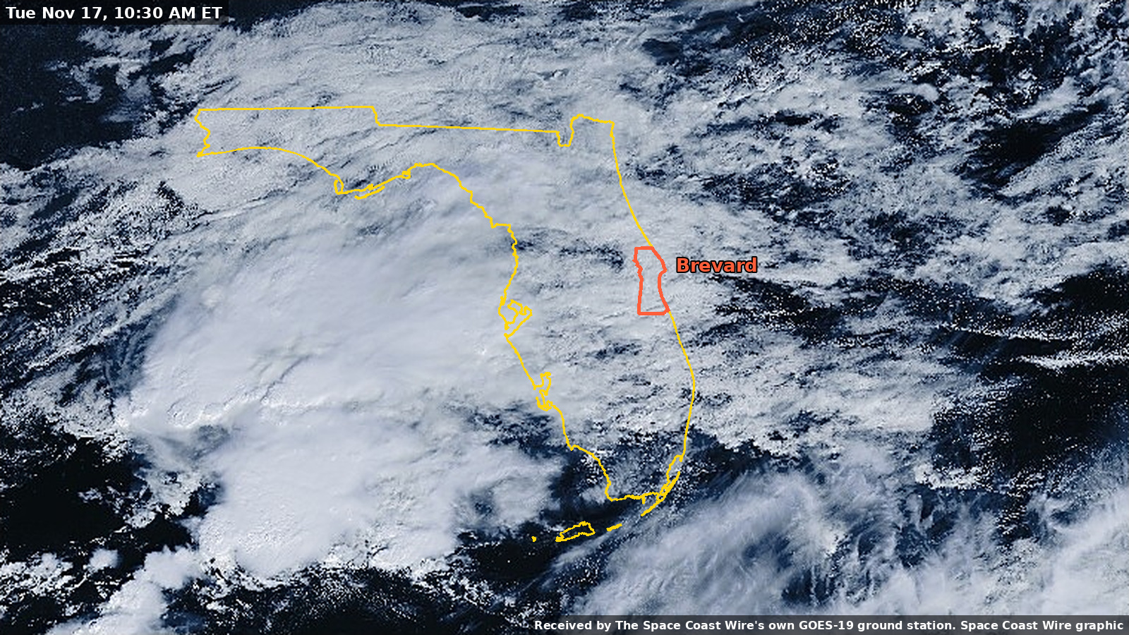
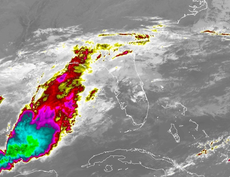
NWS Melbourne forecasts 4 to 6 inches of rain through Friday, with 8 to 12 inches possible near the coast
A Flood Watch remains in effect for all of Brevard County through Friday evening. The Weather Prediction Center has placed the coast in a Moderate risk of excessive rainfall Wednesday through Friday. Melbourne has already recorded 14.37 inches of rain this month, compared with a normal of 1.49 inches.
Written with AI assistance, with sources linked below.
Local Weather
Measured on Brevard's beachside by our own weather station
- Wind
- 9 mph SW, gusts 17 mph
- Rain today
- 3.98 in
- Humidity
- 94%
- Pressure
- 30.14 inHg → steady
Updated 8:24 PM ET
Our station's outlook (based on local readings, not an official forecast)
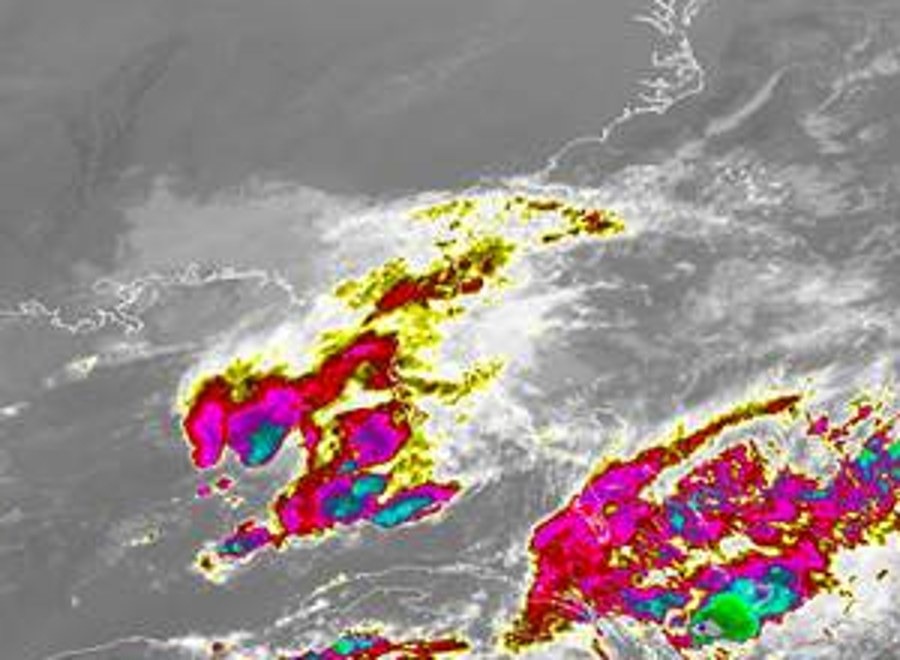
Flood Warning in effect: rain and storms on radar near Brevard now. NWS Melbourne, until Thu 11:00 AM ET.
Based on readings to 8:24 PM ET. Rules: 3- and 12-hour pressure change, wind shift and humidity/dew point trend. For official forecasts and warnings see the National Weather Service in Melbourne.
Sun
Sunrise 6:47 AM · Sunset 5:29 PM
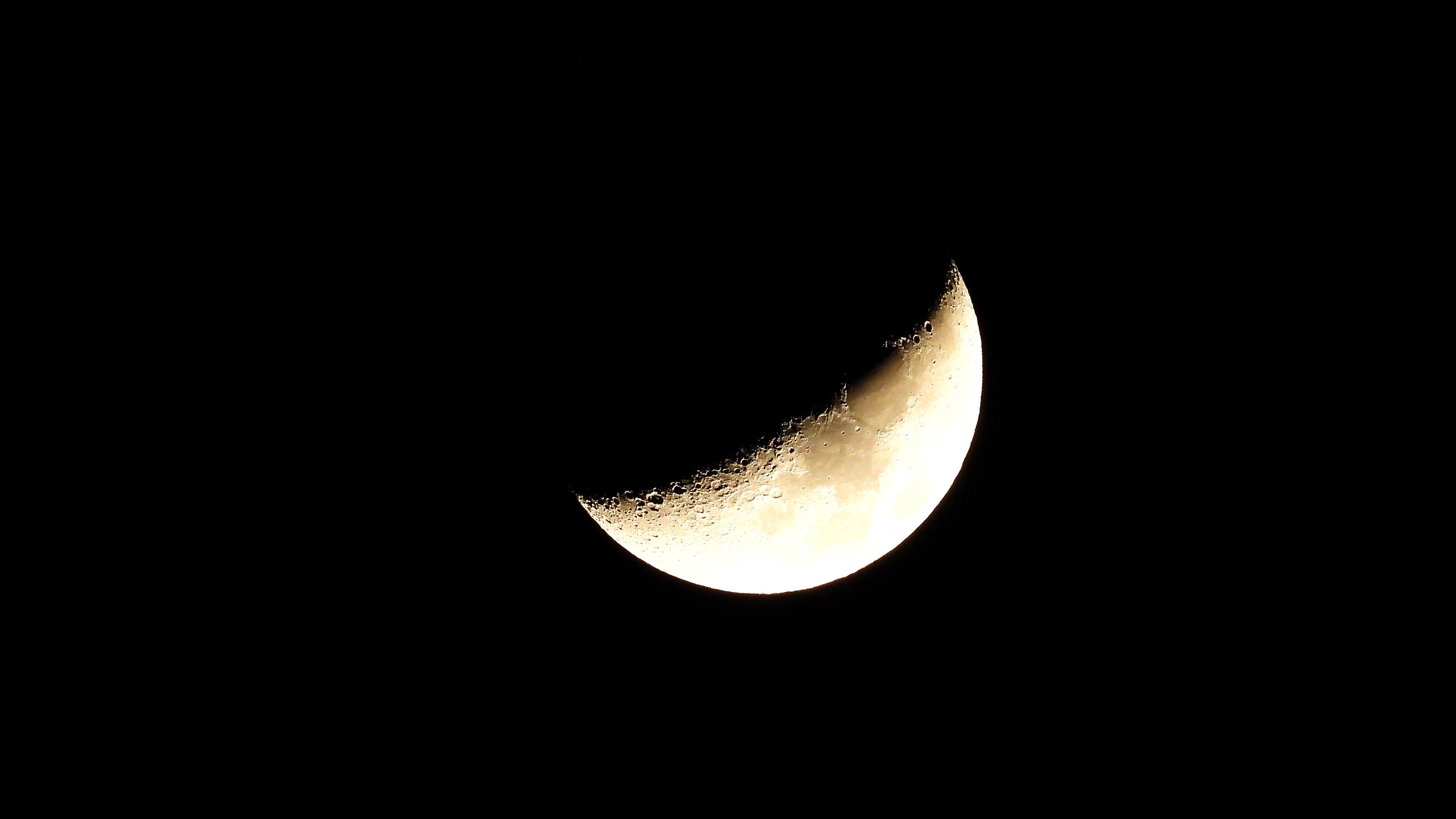
Moon
First Quarter, 67% lit
Sun and moon times are calculated on our server for Brevard's beachside. Daily weather log, records and forecast →
Confirmed by: National Weather Service Melbourne Area Forecast Discussion, issued 3:36 p.m. EST Tuesday, Nov. 17, 2026, NWS Melbourne Area Forecast Discussion, 3:36 p.m. EST Tuesday (API product), Weather Prediction Center Excessive Rainfall Outlook discussion, issued 2:24 p.m. EST Tuesday, Nov. 17, 2026, NWS Melbourne Climate Report for Melbourne, issued 5:31 p.m. EST Tuesday, Nov. 17, 2026, valid as of 5 p.m., NWS Melbourne Climate Report for Melbourne, 5:31 p.m. EST Tuesday (API product), NWS Melbourne Coastal Hazard Message (High Surf Advisory and High Rip Current Risk), issued 2:24 p.m. EST Tuesday, Nov. 17, 2026, NWS Melbourne High Surf Advisory, 2:24 p.m. EST Tuesday, Nov. 17, 2026, NWS Melbourne Rip Current Statement, 2:24 p.m. EST Tuesday, Nov. 17, 2026, NWS Melbourne Small Craft Advisory, 2:30 p.m. EST Tuesday, Nov. 17, 2026, NWS Melbourne Flood Watch, NWS Melbourne Flood Warning, St. Johns River near Cocoa 9w, 9:21 a.m. EST Tuesday, Nov. 17, 2026, NWS Melbourne Flood Warning, St. Johns River above Lake Harney, 9:23 a.m. EST Tuesday, Nov. 17, 2026, NWS Melbourne Flood Warning, St. Johns River near Astor, 9:19 a.m. EST Tuesday, Nov. 17, 2026, NOAA/NWS National Water Prediction Service, St. Johns River near Cocoa (COCF1), NOAA/NWS National Water Prediction Service, St. Johns River above Lake Harney (GENF1), NOAA/NWS National Water Prediction Service, St. Johns River at Astor (ASTF1), Brevard County Emergency Management on X, 4:15 p.m. EST Tuesday, Nov. 17, 2026
This is a follow-up to our Monday report on the Flood Watch and the rain threat for the rest of the week.
The National Weather Service in Melbourne, in its Area Forecast Discussion issued at 3:36 p.m. EST Tuesday, Nov. 17, said widespread rainfall amounts of 4 to 6 inches are forecast through Friday, with locally 8 to 12 inches closer to the coast. "There is a small chance for highly localized amounts of 12"+ focused primarily over portions of Volusia and/or Brevard counties," the weather service wrote. It also said: "Do not drive through flooded roadways if you encounter flooding!"
The Flood Watch issued Monday remains in effect for all of Brevard County from 5 p.m. EST Tuesday through 7 p.m. EST Friday, Nov. 20. NWS Melbourne said the greatest potential for flooding will exist along the coast, but that impacts will be felt over interior sections as well. The weather service is keeping Lake County out of the watch because of less soil saturation.
Excessive rainfall risk
After collaborating with the Weather Prediction Center, NWS Melbourne said a Moderate risk (level 3 out of 4) of excessive rainfall exists for Wednesday through Friday along portions of the northeast and east-central Florida Atlantic coast, with a Slight risk (level 2 out of 4) for much of the interior. "It is unusual for WPC to issue a Moderate risk at Day 4," the Melbourne office wrote.
WPC's Excessive Rainfall Outlook discussion, issued at 2:24 p.m. EST Tuesday, lists a Moderate risk for the Space and Treasure coasts on Wednesday, for the Space Coast and the southern portion of the First Coast on Thursday, and for portions of coastal Florida on Friday, including immediate coastal areas from Melbourne to Jacksonville. WPC said Wednesday remains the likely biggest day of the multi-day rainfall event, with a widespread 3 to 5 inches expected that day from Jacksonville south through around Vero Beach, and locally much higher amounts likely.
NWS Melbourne said rain chances increase tonight (60 to 70 percent) and into Wednesday and Thursday (60 to 80 percent) as showers develop over the coastal waters and push onshore. Primary impacts with showers and isolated lightning storms, the weather service said, will be occasional lightning strikes, gusty winds locally 30 to 45 mph, and torrential downpours.
November rainfall already well above normal
This week's rain would arrive on ground that is already unusually wet for November. NWS Melbourne's climate report issued at 5:31 p.m. EST Tuesday, valid as of 5 p.m., put Melbourne's November rainfall at 14.37 inches, compared with a normal of 1.49 inches for the date, or 12.88 inches above normal. Since Sept. 1, Melbourne has recorded 34.32 inches, compared with a normal of 13.98 inches.
St. Johns River
River flood warnings remain in effect, NWS Melbourne said in the 3:36 p.m. discussion, for the St. Johns River near Cocoa, above Lake Harney, and at Astor. The weather service said extensive flooding continues along the river because of exceptional rainfall in the upper reaches of the basin in previous weeks, and that additional rainfall is forecast to push river levels higher into the weekend.
According to the National Water Prediction Service, with forecasts issued at 9:15 a.m. EST Tuesday:
- At Cocoa, the river was at 17.1 feet at 5:15 p.m. EST Tuesday, in major flood. The forecast holds near 17.1 feet, then 17.2 feet from early Friday through at least Sunday morning, still in major flood. NWS Melbourne said the river west of Cocoa is forecast to remain steady, with slight deviations in river levels, through at least mid to late week. A Flood Warning in effect Tuesday afternoon said that at 17.2 feet, water enters homes along the St. Johns River in the Lake Poinsett area west of Cocoa, as well as low-lying homes in the Silver Pines subdivision in Rockledge and the Shakespeare Park area of Cocoa.
- At the river above Lake Harney, the level was 8.98 feet at 4:30 p.m. EST Tuesday, in minor flood, just below the 9-foot moderate flood stage. The forecast calls for the river to rise to 9.2 feet by Friday evening, in moderate flood. A Flood Warning said minor flooding is occurring and moderate flooding is forecast.
- At Astor, the river was at 2.69 feet at 4:30 p.m. EST Tuesday, in minor flood. The forecast rises to 3 feet, the moderate flood stage, Thursday afternoon and to 3.4 feet by Sunday morning. A Flood Warning said minor flooding is occurring and moderate flooding is forecast.
Surf, rip currents and marine conditions
NWS Melbourne issued a High Surf Advisory at 2:24 p.m. EST Tuesday, in effect until 7 a.m. EST Friday, for coastal Volusia, Brevard, Indian River, St. Lucie and Martin counties, including Brevard's mainland and barrier island zones. The advisory calls for large breaking waves of 5 to 11 feet in the surf zone. In the afternoon forecast discussion, the weather service said rough, pounding surf will promote moderate to locally major beach erosion along the coast.
A High Rip Current Risk remains in effect through Thursday evening. NWS Melbourne said a high risk for numerous, strong, life-threatening rip currents will exist at area beaches, and that entering the rough and dangerous surf is strongly discouraged.
A Small Craft Advisory has been extended until 3 p.m. EST Friday. The advisory, issued at 2:30 p.m. EST Tuesday, calls for east winds of 20 to 30 knots with occasional gusts to gale force, and seas building 8 to 13 feet. In the marine discussion, NWS Melbourne said that depending on the strength of low pressure developing near or over the northwest Bahamas, any further increase in winds may require a Gale Warning. Seas are forecast to build to 7 to 9 feet tonight, then 8 to 13 feet Wednesday and Thursday, with only minimal improvement into Friday and Saturday.
Later in the week
NWS Melbourne said models are in fairly good agreement on developing low pressure near the northern Bahamas on Friday and lifting it northward offshore the Florida east coast on Saturday. Easterly winds are expected to decrease into the weekend, becoming north or northeast Saturday afternoon and north or northwest Saturday night through Monday, which the weather service said should pull in some drier air Sunday and Monday.
Sandbags
Free sandbags will be available to Brevard County residents again from 7 a.m. to 6 p.m. (or dark) on Wednesday, Nov. 18, Brevard County Emergency Management said at 4:15 p.m. Tuesday. Wednesday's sites are Phantom Fireworks, 2725 W. King St. #520, Cocoa; New Shiloh Christian Center, 3900 Sarno Road, Melbourne; and The Compound in Palm Bay, entered at J.A. Bombardier Boulevard and DeGroodt Road SW. The Palm Bay site was moved from the Eastern Florida State College campus because of traffic impacts. Times, addresses and Tuesday's distribution notes are in our earlier Flood Watch story.
Sources
- NWS Melbourne Area Forecast Discussion, issued 3:36 p.m. EST Tuesday, Nov. 17, 2026 forecast.weather.gov/product.php?issuedby=MLB&product=AFD&site=NWS
- NWS Melbourne Area Forecast Discussion, 3:36 p.m. EST Tuesday (API product 361c68c9-085b-434e-8dd4-5fc283a7e6d3) api.weather.gov/products/361c68c9-085b-434e-8dd4-5fc283a7e6d3
- Weather Prediction Center Excessive Rainfall Outlook discussion, issued 2:24 p.m. EST Tuesday, Nov. 17, 2026, last updated 2:25 p.m. EST www.wpc.ncep.noaa.gov/discussions/qpferd.html
Show all 19 sourcesShow fewer
- Weather Prediction Center Excessive Rainfall Outlooks www.wpc.ncep.noaa.gov/qpf/excessive_rainfall_outlook_ero.php
- NWS Melbourne Climate Report for Melbourne, issued 5:31 p.m. EST Tuesday, Nov. 17, 2026, valid as of 5 p.m. forecast.weather.gov/product.php?issuedby=MLB&product=CLI&site=NWS
- NWS Melbourne Climate Report for Melbourne, 5:31 p.m. EST Tuesday (API product) api.weather.gov/products/09113932-d435-4772-af10-8cda50b90175
- NWS Melbourne Coastal Hazard Message, issued 2:24 p.m. EST Tuesday, Nov. 17, 2026 (API product) api.weather.gov/products/1521c746-fa2c-42d9-897c-f42abcf28af8
- NWS Melbourne Coastal Hazard Message (product page) forecast.weather.gov/product.php?issuedby=MLB&product=CFW&site=NWS
- NWS Melbourne High Surf Advisory, issued 2:24 p.m. EST Tuesday until 7 a.m. EST Friday, Nov. 20, 2026 api.weather.gov/alerts/urn:oid:2.49.0.1.840.0.ff80e8bf1b2b9a3084b069188ba8462455aa9cc2.001.1
- NWS Melbourne Rip Current Statement, issued 2:24 p.m. EST Tuesday through Thursday evening, Nov. 19, 2026 api.weather.gov/alerts/urn:oid:2.49.0.1.840.0.ff80e8bf1b2b9a3084b069188ba8462455aa9cc2.001.2
- NWS Melbourne Small Craft Advisory, issued 2:30 p.m. EST Tuesday until 3 p.m. EST Friday, Nov. 20, 2026 api.weather.gov/alerts/urn:oid:2.49.0.1.840.0.82b092913f0099e0d1c5b608e17716165ef245df.001.1
- NWS Melbourne Flood Watch, issued 3:18 p.m. EST Monday until 7 p.m. EST Friday, Nov. 20, 2026 api.weather.gov/alerts/urn:oid:2.49.0.1.840.0.8c11a51fff36cca6e5c7d021e392a554c3802420.001.1
- NWS Melbourne Flood Warning, St. Johns River near Cocoa 9w, issued 9:21 a.m. EST Tuesday, Nov. 17, 2026 api.weather.gov/alerts/urn:oid:2.49.0.1.840.0.2ab0dcba67e466e668b37501d5d7ce7c9754bce6.001.1
- NWS Melbourne Flood Warning, St. Johns River above Lake Harney, issued 9:23 a.m. EST Tuesday, Nov. 17, 2026 api.weather.gov/alerts/urn:oid:2.49.0.1.840.0.e2e31c24b8041ae6d756ab51ac1361073e194021.001.1
- NWS Melbourne Flood Warning, St. Johns River near Astor, issued 9:19 a.m. EST Tuesday, Nov. 17, 2026 api.weather.gov/alerts/urn:oid:2.49.0.1.840.0.9edc51686030f142841e097165571852187d4062.001.1
- NOAA/NWS National Water Prediction Service: St. Johns River near Cocoa (COCF1); observation 17.1 feet at 5:15 p.m. EST Tuesday; forecast issued 9:15 a.m. EST Tuesday water.noaa.gov/gauges/COCF1
- NOAA/NWS National Water Prediction Service: St. Johns River above Lake Harney (GENF1); observation 8.98 feet at 4:30 p.m. EST Tuesday; forecast issued 9:15 a.m. EST Tuesday water.noaa.gov/gauges/GENF1
- NOAA/NWS National Water Prediction Service: St. Johns River at Astor (ASTF1); observation 2.69 feet at 4:30 p.m. EST Tuesday; forecast issued 9:15 a.m. EST Tuesday water.noaa.gov/gauges/ASTF1
- Brevard County Emergency Management on X, 4:15 p.m. EST Tuesday, Nov. 17, 2026 x.com/BrevardEOC/status/2122801843185053825
Spot something wrong? Request a correction · Our standards
Comments
Keep it friendly. Rude, hostile or personal-attack comments will be removed.