Flood Watch covers all of Brevard from Tuesday afternoon through Friday as heavy coastal rain is forecast
NWS Melbourne issued a Flood Watch for all of Brevard County from Tuesday afternoon through Friday evening, forecasting 3 to 6 inches of rain with localized amounts of 8 to 12 inches, highest in the coastal counties. A High Surf Advisory for 5- to 11-foot breaking waves runs from 7 p.m. Tuesday until 7 a.m. Friday, the high rip current risk runs through Thursday evening, and the Small Craft Advisory runs until 3 p.m. Friday.
Written with AI assistance, with sources linked below.
Local Weather
Measured on Brevard's beachside by our own weather station
- Wind
- 9 mph SW, gusts 17 mph
- Rain today
- 3.98 in
- Humidity
- 94%
- Pressure
- 30.14 inHg → steady
Updated 8:24 PM ET
Our station's outlook (based on local readings, not an official forecast)
Flood Warning in effect: rain and storms on radar near Brevard now. NWS Melbourne, until Thu 11:00 AM ET.
Based on readings to 8:24 PM ET. Rules: 3- and 12-hour pressure change, wind shift and humidity/dew point trend. For official forecasts and warnings see the National Weather Service in Melbourne.
Sun
Sunrise 6:47 AM · Sunset 5:29 PM
Moon
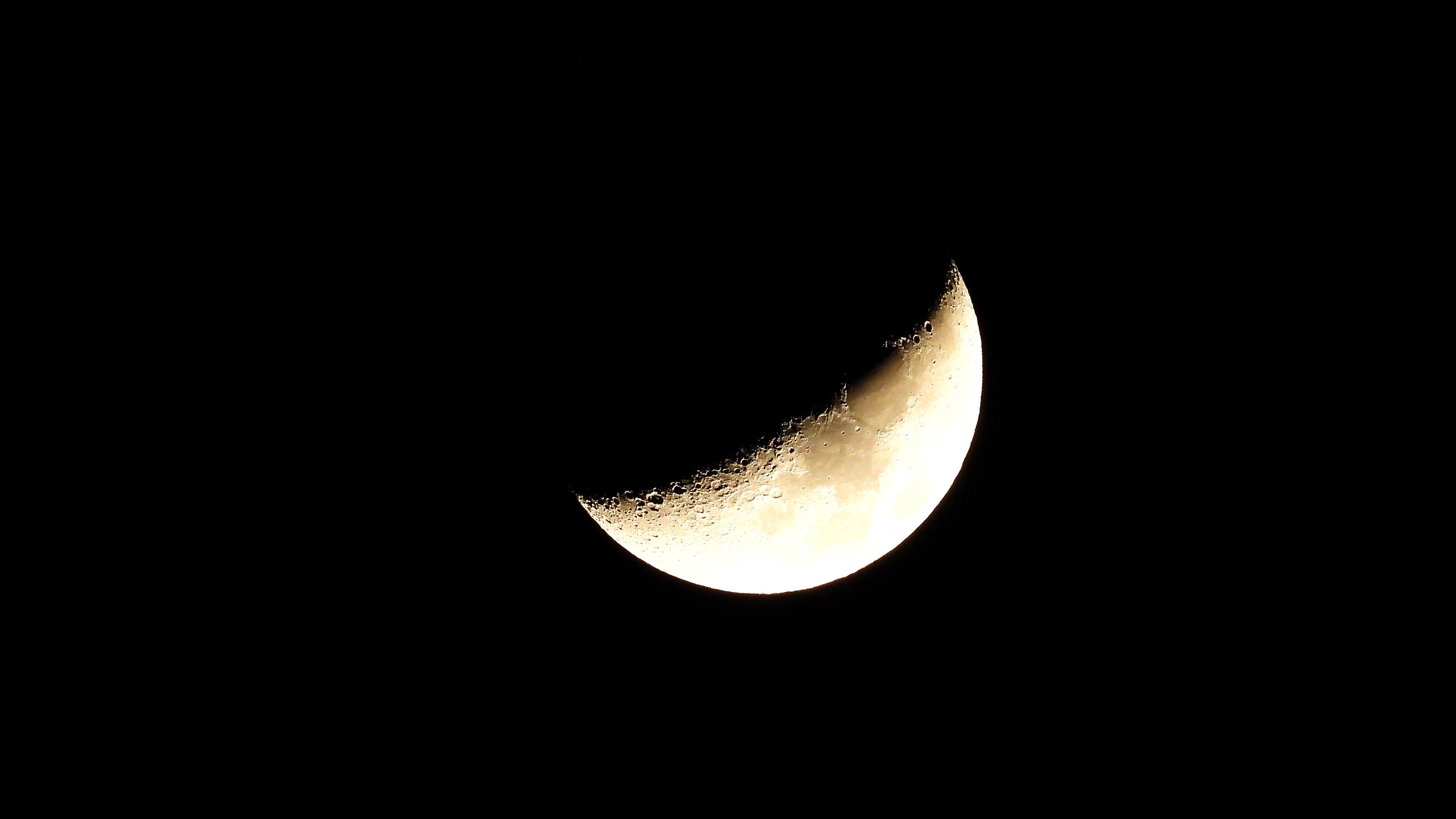
First Quarter, 67% lit
Sun and moon times are calculated on our server for Brevard's beachside. Daily weather log, records and forecast →
Confirmed by: Brevard County Emergency Management on X, 4:15 p.m. EST Tuesday, Nov. 17, 2026, NWS Melbourne High Surf Advisory, 2:24 p.m. EST Tuesday, Nov. 17, 2026, NWS Melbourne Rip Current Statement, 2:24 p.m. EST Tuesday, Nov. 17, 2026, NWS Melbourne Small Craft Advisory, 2:30 p.m. EST Tuesday, Nov. 17, 2026, Melbourne Police Department on X, 8:53 a.m. EST Tuesday, Nov. 17, 2026, City of Titusville on X, 8:58 a.m. EST Tuesday, Nov. 17, 2026, NWS Melbourne High Surf Advisory, 1:28 a.m. EST Tuesday, Nov. 17, 2026, NWS Melbourne Rip Current Statement, 1:28 a.m. EST Tuesday, Nov. 17, 2026, NWS Melbourne Small Craft Advisory, 1:29 a.m. EST Tuesday, Nov. 17, 2026, NWS Melbourne on X, 6:01 a.m. EST Tuesday, Nov. 17, 2026, NWS Melbourne Flood Watch, National Weather Service Melbourne Area Forecast Discussion, issued 7 p.m. EST Monday, Nov. 16, 2026, NWS Melbourne Flood Warning, St. Johns River near Cocoa, 8:20 p.m. EST Monday, Nov. 16, 2026, NWS Melbourne Climate Report for Melbourne, 5:30 p.m. EST Monday, Nov. 16, 2026, NOAA/NWS National Water Prediction Service, St. Johns River near Cocoa (COCF1), National Hurricane Center Atlantic Tropical Weather Outlook, 7 p.m. EST Monday, Nov. 16, 2026, National Weather Service Melbourne forecast graphic dated Nov. 16, 2026, shared by Brevard County Emergency Management, Weather Prediction Center Excessive Rainfall Outlooks, 10:58 a.m. EST Monday, Nov. 16, 2026, Brevard County Emergency Management, City of Titusville News Flash: Sandbags Available for Titusville Residents, Nov. 16, 2026
Updates
- NWS Melbourne, in its 3:36 p.m. EST Tuesday forecast discussion, said widespread rainfall amounts of 4 to 6 inches are forecast through Friday, with locally 8 to 12 inches closer to the coast. See our follow-up story.
- Brevard County Emergency Management said free sandbags will be available again Wednesday, Nov. 18, from 7 a.m. to 6 p.m. (or dark) in Cocoa and Melbourne, with the Palm Bay site moved to The Compound (J.A. Bombardier Boulevard and DeGroodt Road SW) because of traffic impacts.
- NWS Melbourne extended the High Surf Advisory for Brevard's coast until 7 a.m. Friday and raised the expected breaking waves to 5 to 11 feet. The Small Craft Advisory now runs until 3 p.m. Friday, with occasional gusts to gale force. The high rip current risk is unchanged, through Thursday evening.
- Melbourne police said eastbound Sarno Road at Eau Gallie Boulevard is shut down because of the sandbag distribution; drivers heading for sandbags should come west on Sarno from Wickham Road. The City of Titusville said its self-service sandbag station was resupplied Tuesday morning and is open 24/7.
- NWS Melbourne issued a High Surf Advisory for Brevard's coast from 7 p.m. Tuesday to 1 p.m. Thursday (5- to 10-foot breaking waves, localized beach erosion), and extended the High Rip Current Risk through Thursday evening and the Small Craft Advisory until 4 p.m. Thursday. Added NWS Melbourne's Tuesday morning note that the coast is in a Slight Risk (2 of 4) of excessive rainfall.
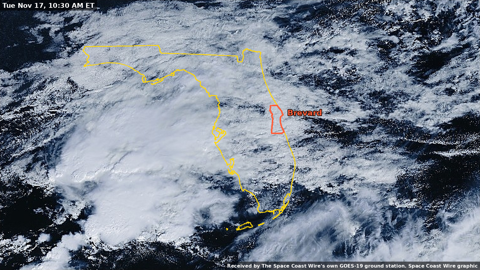
- Added Melbourne's November rainfall total, the latest St. Johns River near Cocoa reading and forecast, NWS Melbourne's 7 p.m. forecast discussion on coastal flood risk, surf and rip currents, the National Hurricane Center's latest tropical outlook, and a GOES-19 satellite image from Monday morning.
- Added the City of Titusville's self-service sandbag station at 385 N. Singleton Ave. for city residents, announced Monday.
- NWS Melbourne issued a Flood Watch for all of Brevard County from 5 p.m. Tuesday through 7 p.m. Friday, forecasting 3 to 6 inches of rain with localized 8 to 12 inches. Headline and summary updated (previous headline: "More rain on the way for flood-weary Brevard, with heaviest totals expected along the coast").
- Added free sandbag locations and hours for Tuesday, Nov. 17, announced by Brevard County Emergency Management at 3 p.m. Monday.
- Expanded this story this afternoon with official day-by-day NWS Melbourne forecasts for Melbourne, Cocoa, Titusville and Palm Bay, Weather Prediction Center excessive rainfall outlooks, and the Small Craft Advisory, High Rip Current Risk and St. Johns River Flood Warning still in effect.
Update, Tuesday evening, Nov. 17: NWS Melbourne now forecasts widespread rainfall amounts of 4 to 6 inches through Friday, with locally 8 to 12 inches closer to the coast. Read the follow-up.
More rain is headed for Brevard County this week while neighborhoods are still cleaning up from the early-November flooding. The National Weather Service in Melbourne, in its Area Forecast Discussion issued at 1:50 a.m. EST Monday, Nov. 16 (aviation section updated at 6:21 a.m. EST), says isolated to widely scattered onshore-moving showers will develop today, with the greatest threat later in the day and tonight, then rain chances increase Tuesday through late week. Brevard County Emergency Management shared that outlook at noon Monday and said the weather service expects rain to start as early as Monday afternoon and continue through the week.
Flood Watch issued
At 3:18 p.m. EST Monday, NWS Melbourne issued a Flood Watch for most of east-central Florida, including all of Brevard County's mainland, inland and barrier island zones, in effect from 5 p.m. EST Tuesday, Nov. 17, through 7 p.m. EST Friday, Nov. 20. The weather service says flooding caused by excessive rainfall is possible as repeated rounds of showers and isolated storms move through. It forecasts 3 to 6 inches of rain with localized amounts of 8 to 12 inches, with the greatest potential for the higher amounts over the coastal counties, and warns that runoff may flood rivers, creeks, streams and other low-lying, flood-prone areas. A watch means flooding is possible, not that it is happening. The weather service asks residents to monitor later forecasts, be alert for possible Flood Warnings, and be ready to act if flooding develops, especially in flood-prone areas.
When the rain arrives
According to NWS Melbourne's gridpoint forecasts generated around 11:06 a.m. EST Monday (the Palm Bay and Cocoa Beach forecasts were generated at about 1:11 p.m. EST), Monday stays mostly cloudy with a chance of showers:
- Melbourne: 40 percent today and 50 percent tonight, with a high near 76. New rainfall of a tenth to a quarter of an inch is possible today, and less than a tenth of an inch tonight.
- Cocoa: 30 percent today and 40 percent tonight, with a high near 75 and less than a tenth of an inch possible in each period.
- Titusville: 30 percent today and 40 percent tonight, with a high near 74. A tenth to a quarter of an inch is possible tonight.
- Palm Bay: 40 percent this afternoon and 50 percent tonight, with a high near 76 and less than a tenth of an inch possible in each period.
The weather service says activity increases Tuesday and Tuesday night, with rain chances of 40 to 80 percent areawide, the highest potential along the coast and likely at night. City forecasts put Tuesday's chance at 60 percent in Melbourne, 70 percent in Cocoa and Titusville, and 50 percent in Palm Bay, rising to 80 percent Tuesday night in all four cities as showers give way to thunderstorms after midnight in several of the forecasts.
Wednesday looks like the wettest day in the official forecasts, with an 80 percent chance of showers and thunderstorms from Titusville to Palm Bay. Thursday remains wet, with an 80 percent chance in Melbourne and Palm Bay, 70 percent in Cocoa and 60 percent in Titusville. Friday's chance is about 60 percent in those cities. Rain chances then gradually decrease into the weekend, to about 30 percent Saturday and 20 percent Sunday in the Melbourne forecast. The weather service does not give a hard end time for the rain. It says chances taper slowly as a low near the Bahamas tracks northeast away from eastern Florida this weekend.
How much rain, and where
On Tuesday morning, NWS Melbourne said increasing coverage of showers and storms begins today, with the east-central Florida coast in a Slight Risk (level 2 of 4) of excessive rainfall. It said localized flooding will be possible, especially along the coast, with a chance for some spots to see 4 inches or more.
In the Monday morning discussion, NWS Melbourne said isolated amounts of up to 2 to 4 inches or more are possible Tuesday through Tuesday night, highest along the coast, and that it is difficult to pinpoint exactly where the heaviest rain could fall. For Wednesday through Friday, the office said heavy onshore-moving rain bands may set up over the coastal waters and move onto the coast. The Weather Prediction Center has outlooked east-central Florida under a Marginal to Slight risk (levels 1 to 2 out of 4) of excessive rainfall those three days. NWS Melbourne said widespread totals of 2 to 4 inches seem appropriate for now, with isolated amounts of 5 to 7 inches or more possible through Friday.
A National Weather Service Melbourne forecast graphic dated Nov. 16, shared by the county at noon, puts that in event-total terms: persistent easterly winds will support repeated rounds of onshore-moving showers and storms, especially from Tuesday on, with the potential for widespread 4 to 6 inch totals through the event and localized amounts exceeding 8 inches. The same graphic's high-end outlook, labeled as a 1-in-10 chance of being exceeded through Thursday, shows 6 to 8 inches around Melbourne and 4 to 6 inches around Titusville.
The Weather Prediction Center's excessive rainfall outlooks issued at 10:58 a.m. EST Monday show no excessive rainfall risk today into Tuesday morning. The probability of rainfall exceeding flash flood guidance is less than 5 percent for that period. A Slight Risk is in effect for the Florida east coast on Day 2 (7 a.m. EST Tuesday through 7 a.m. EST Wednesday) and Day 3 (7 a.m. EST Wednesday through 7 a.m. EST Thursday). The center said locally heavy totals of 3 to 5 inches or more and scattered flash flooding are possible in those periods, with rain rates in the more intense storms on Tuesday possibly reaching 2 to 3 inches per hour. The Melbourne office graphic also shows a Slight Risk along the coast and a Marginal Risk inland each day from Tuesday through Friday, Nov. 20.
In its 7 p.m. EST Monday Area Forecast Discussion, NWS Melbourne said the risk of excessive rainfall and flooding of roadways and low-lying areas has increased Tuesday through Friday, and that the greatest potential for flooding will exist along the coast. NWS Melbourne has previously said flooding is a particular concern in areas that have already been soaked. Isolated thunderstorms Tuesday and Tuesday night could also bring occasional lightning and locally gusty winds of 30 to 40 mph, along with torrential downpours. A low chance of lightning storms continues later in the week.
Melbourne has already had a very wet November. In the climate report issued at 5:30 p.m. EST Monday, valid as of 5 p.m., NWS Melbourne said Melbourne International Airport has recorded 13.85 inches of rain so far this month, compared with a normal of 1.43 inches for this point in November.
St. Johns River
A Flood Warning remains in effect until further notice for the St. Johns River near Cocoa, west of the city. In an 8:20 p.m. EST Monday statement, NWS Melbourne said major flooding is occurring and major flooding is forecast. The river was at 17.1 feet at 7:15 p.m. EST, with flood stage at 16.0 feet, and was expected to remain steady above flood stage at 17.1 feet, with slight deviations in river levels through mid to late week. The National Water Prediction Service showed the river still at 17.1 feet at 9:15 p.m. EST Monday. Its forecast, issued at 8:04 p.m. EST Monday, keeps the river near 17.1 feet into Thursday, then 17.2 feet from early Friday through Saturday. At 17.2 feet, the weather service says water can enter homes along the river in the Lake Poinsett area west of Cocoa, and low-lying homes in the Silver Pines subdivision in Rockledge and the Shakespeare Park area of Cocoa, and that Providence Road west of Cocoa can become impassable. The next statement is expected Tuesday morning at 11 a.m. EST. Latest river forecasts are at water.noaa.gov/wfo/MLB. See our river coverage.
Wind, boats and beaches
East to northeast winds are becoming breezy to windy. The morning discussion calls for winds around 15 mph today with gusts of 20 to 25 mph, then 15 to 20 mph along the Space Coast tonight with frequent gusts of 25 to 30 mph, and sustained winds of 15 to 25 mph Tuesday with frequent gusts of 20 to 30 mph, highest along the coast, and occasional gusts to 35 mph possible at the coast. Midweek stays breezy and gusty. The Melbourne and Palm Bay point forecasts for Wednesday call for north-northeast winds of 20 to 25 mph with gusts as high as 35 mph. The Cocoa Beach forecast has north-northeast winds of 25 to 30 mph with gusts as high as 40 mph Wednesday and Wednesday night.
NWS Melbourne updated its coastal hazards again at 2:24 p.m. EST Tuesday, Nov. 17. The High Surf Advisory for all of Brevard's coastal zones, from Mainland Northern Brevard and the Northern Brevard Barrier Islands to Mainland Southern Brevard and the Southern Brevard Barrier Islands, now runs until 7 a.m. EST Friday, Nov. 20, extended from 1 p.m. Thursday. The weather service now expects large breaking waves of 5 to 11 feet in the surf zone, with dangerous swimming and surfing conditions and localized beach erosion.
The High Rip Current Risk for Brevard beaches remains in effect through Thursday evening (the statement runs until 7 p.m. EST Thursday). The weather service warns that rip currents can sweep even the best swimmers away from shore into deeper water.
The Small Craft Advisory for the Atlantic coastal waters out to 60 nautical miles, including the Volusia-Brevard County line to Sebastian Inlet, was extended again at 2:30 p.m. Tuesday and now runs until 3 p.m. EST Friday. It calls for east winds of 20 to 30 knots with occasional gusts to gale force and seas building to 8 to 13 feet, conditions the weather service calls hazardous to small craft.
Tropics
The National Hurricane Center's Tropical Weather Outlook issued at 7 p.m. EST Monday said tropical cyclone formation is not expected in the Atlantic, Caribbean Sea or Gulf of America during the next 7 days.
Free sandbags Tuesday and Wednesday
Brevard County Emergency Management said at 4:15 p.m. Tuesday that free sandbags will be available to Brevard County residents again from 7 a.m. to 6 p.m. (or dark) on Wednesday, Nov. 18. The Palm Bay site has moved because of traffic impacts. Wednesday's locations are:
- Phantom Fireworks, 2725 W. King St. #520, Cocoa
- New Shiloh Christian Center, 3900 Sarno Road, Melbourne
- The Compound in Palm Bay (enter at the corner of J.A. Bombardier Boulevard and DeGroodt Road SW), replacing the Eastern Florida State College Palm Bay Campus site
Tuesday's distribution, announced Monday, used these sites:
Brevard County Emergency Management said at 3 p.m. Monday that free sandbags will be available to Brevard County residents from 7 a.m. to 6 p.m. (or dark) on Tuesday, Nov. 17, at three locations:
- Phantom Fireworks, 2725 W. King St. #520, Cocoa
- New Shiloh Christian Center, 3900 Sarno Road, Melbourne
- Eastern Florida State College Palm Bay Campus, 250 Community College Parkway, Palm Bay
Traffic note: at 8:53 a.m. Tuesday, Melbourne police said eastbound Sarno Road at Eau Gallie Boulevard was shut down because of the sandbag distribution in the area. Police ask drivers to avoid the area if possible, and say people heading to get sandbags should travel west on Sarno Road from Wickham Road.
In Titusville, the City of Titusville said Monday it has opened a self-service sandbag filling station at 385 N. Singleton Ave. for city residents. Empty bags and sand are on site, along with a limited number of shovels. The station is not staffed, so residents should come ready to fill and load their own bags, and the city asks people to take only what they need. On Tuesday morning the city said the station was resupplied with fresh sand and empty bags, still has a limited number of shovels, and is open 24/7.
What residents can do
NWS Melbourne and the Flood Warning include these precautions:
- If you live in a flood-prone area, be prepared to act if flooding develops, and watch for any Flood Warnings.
- Do not drive through flooded roadways. Do not drive around barricades.
- Use extra caution near riverbanks.
- At the beach, heed lifeguards, flags and signs. If caught in a rip current, relax and float. Do not swim against the current. If you can, swim in a direction following the shoreline. If you cannot escape, face the shore and call or wave for help.
- Small craft should stay out of the hazardous coastal waters while the advisory is in effect.
- Check later forecasts at weather.gov/mlb and river levels at water.noaa.gov/wfo/MLB, because where the heaviest rain bands set up is still uncertain.
This account was updated Monday evening with NWS Melbourne's 7 p.m. EST Area Forecast Discussion, the 8:20 p.m. EST Flood Warning for the St. Johns River near Cocoa, the 5:30 p.m. EST Melbourne climate report, the National Water Prediction Service river forecast, and the National Hurricane Center's 7 p.m. EST Tropical Weather Outlook. Earlier portions of this story are based on official National Weather Service Melbourne products from Monday morning and afternoon, including gridpoint forecasts, the 3:18 p.m. EST Flood Watch, the Small Craft Advisory and Rip Current Statement, and Weather Prediction Center excessive rainfall outlooks issued at 10:58 a.m. EST.
Sources
- NWS Melbourne Flood Watch, issued 3:18 p.m. EST Monday until 7 p.m. EST Friday, Nov. 20, 2026 api.weather.gov/alerts/urn:oid:2.49.0.1.840.0.8c11a51fff36cca6e5c7d021e392a554c3802420.001.1
- NWS Melbourne Area Forecast Discussion, 7 p.m. EST Monday, Nov. 16, 2026 (discussion and marine sections issued 1:55 p.m. EST) forecast.weather.gov/product.php?issuedby=MLB&product=AFD&site=NWS
- NWS Melbourne Area Forecast Discussion, 7 p.m. EST Monday (API product) api.weather.gov/products/3be613f3-e9fc-4a40-865f-384f0edf099a
Show all 31 sourcesShow fewer
- NWS Melbourne Area Forecast Discussion, 1:56 p.m. EST Monday, Nov. 16, 2026 (API product) api.weather.gov/products/e1a0d85b-4f57-411c-b5d4-6ab15acf814f
- NWS Melbourne Flood Warning, St. Johns River near Cocoa 9w, issued 8:20 p.m. EST Monday, Nov. 16, 2026 api.weather.gov/alerts/urn:oid:2.49.0.1.840.0.4d24dcf3b1dca46b1c14a715c8538e8db6169665.001.1
- NOAA/NWS National Water Prediction Service: St. Johns River near Cocoa (COCF1), forecast issued 8:04 p.m. EST Monday, Nov. 16, 2026, observations through 9:15 p.m. EST water.noaa.gov/gauges/COCF1
- NWS Melbourne Climate Report for Melbourne, issued 5:30 p.m. EST Monday, Nov. 16, 2026, valid as of 5 p.m. forecast.weather.gov/product.php?issuedby=MLB&product=CLI&site=NWS
- NWS Melbourne Climate Report for Melbourne, 5:30 p.m. EST Monday (API product) api.weather.gov/products/6bcd1f77-fa95-4c51-ba2c-6c2a6ac3f248
- National Hurricane Center Atlantic Tropical Weather Outlook, 7 p.m. EST Monday, Nov. 16, 2026 www.nhc.noaa.gov/text/MIATWOAT.shtml
- NWS Melbourne Area Forecast Discussion, 6:21 a.m. EST Monday, Nov. 16, 2026 (key messages and discussion issued 1:50 a.m. EST) forecast.weather.gov/product.php?issuedby=MLB&product=AFD&site=NWS
- NWS Melbourne Area Forecast Discussion (API product) api.weather.gov/products/ea177f36-f482-4d3d-ad8e-324e6470dac1
- NWS api.weather.gov gridpoint forecast for Melbourne (MLB 58,51), generated 11:06 a.m. EST Monday, Nov. 16, 2026 api.weather.gov/gridpoints/MLB/58,51/forecast
- NWS api.weather.gov gridpoint forecast for Cocoa (MLB 51,64), generated 11:06 a.m. EST Monday, Nov. 16, 2026 api.weather.gov/gridpoints/MLB/51,64/forecast
- NWS api.weather.gov gridpoint forecast for Titusville (MLB 48,74), generated 11:07 a.m. EST Monday, Nov. 16, 2026 api.weather.gov/gridpoints/MLB/48,74/forecast
- NWS api.weather.gov gridpoint forecast for Palm Bay (MLB 59,49), generated 1:11 p.m. EST Monday, Nov. 16, 2026 api.weather.gov/gridpoints/MLB/59,49/forecast
- NWS api.weather.gov gridpoint forecast for Cocoa Beach (MLB 57,62), generated 1:11 p.m. EST Monday, Nov. 16, 2026 api.weather.gov/gridpoints/MLB/57,62/forecast
- NWS Melbourne Zone Forecast Product, 2:45 a.m. EST Monday, Nov. 16, 2026 forecast.weather.gov/product.php?issuedby=MLB&product=ZFP&site=NWS
- National Weather Service Melbourne forecast graphic dated Nov. 16, 2026, shared by Brevard County Emergency Management on X x.com/BrevardEOC/status/2122376661790495211
- Weather Prediction Center Day 1 Excessive Rainfall Outlook, 10:58 a.m. EST Monday, Nov. 16, 2026 www.wpc.ncep.noaa.gov/qpf/ero.php?day=1
- Weather Prediction Center Day 2 Excessive Rainfall Outlook, 10:58 a.m. EST Monday, Nov. 16, 2026 www.wpc.ncep.noaa.gov/qpf/ero.php?day=2&opt=curr
- Weather Prediction Center Day 3 Excessive Rainfall Outlook, 10:58 a.m. EST Monday, Nov. 16, 2026 www.wpc.ncep.noaa.gov/qpf/ero.php?day=3&opt=curr
- NWS Melbourne Flood Warning, St. Johns River near Cocoa 9w, issued 9:49 a.m. EST Monday, Nov. 16, 2026 api.weather.gov/alerts/urn:oid:2.49.0.1.840.0.1ca005f84bb2b4a825c2afb3274f005a72bbfc98.002.1
- NWS Melbourne Small Craft Advisory, issued 1:28 a.m. EST Monday until 7 p.m. EST Wednesday, Nov. 18, 2026 api.weather.gov/alerts/urn:oid:2.49.0.1.840.0.218bd5ddc7e6e19846606c1ee56a5b0bcc865add.001.1
- NWS Melbourne Rip Current Statement (High Rip Current Risk), issued 1:25 a.m. EST Monday until 7 p.m. EST Wednesday, Nov. 18, 2026 api.weather.gov/alerts/urn:oid:2.49.0.1.840.0.3e1742fb10cde3aae5797008dd2b82ace4ea0375.001.1
- NWS Melbourne Coastal Hazard Message / Coastal Flood product, 1:25 a.m. EST Monday, Nov. 16, 2026 forecast.weather.gov/product.php?issuedby=MLB&product=CFW&site=NWS
- NWS Melbourne Coastal Waters Forecast forecast.weather.gov/product.php?issuedby=MLB&product=CWF&site=NWS
- NOAA/NWS National Water Prediction Service: Melbourne area river forecasts water.noaa.gov/wfo/MLB
- National Weather Service Melbourne www.weather.gov/mlb/
- Brevard County Emergency Management on X, noon Monday, Nov. 16, 2026 x.com/BrevardEOC/status/2122376661790495211
- Brevard County Emergency Management on X, free sandbag distribution, 3 p.m. Monday, Nov. 16, 2026 x.com/BrevardEOC/status/2122420539310448943
- City of Titusville News Flash: Sandbags Available for Titusville Residents, Nov. 16, 2026 www.titusville.com/CivicAlerts.aspx
Spot something wrong? Request a correction · Our standards
Comments
Keep it friendly. Rude, hostile or personal-attack comments will be removed.