Flash Flood Warnings cover Melbourne, Palm Bay and Titusville areas after up to 10 inches of rain
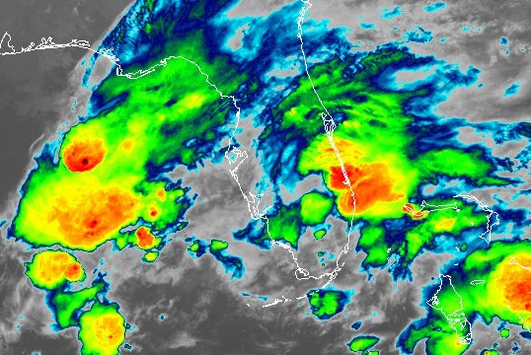
NWS Melbourne calls the flooding life-threatening in southern Brevard, where radar showed 6 to 8 inches had fallen by early Monday, with more possible.
Written with AI assistance, with sources linked below.
Local Weather
Measured on Brevard's beachside by our own weather station
- Wind
- 4 mph S, gusts 8 mph
- Rain today
- 7.74 in
- Humidity
- 99%
- Pressure
- 30.12 inHg ↑ rising
Updated 8:42 AM ET
Our station's outlook (based on local readings, not an official forecast)
Flash Flood Warning in effect: rain and storms on radar near Brevard now. NWS Melbourne, until 10:00 AM ET.
Based on readings to 8:42 AM ET. Rules: 3- and 12-hour pressure change, wind shift and humidity/dew point trend. For official forecasts and warnings see the National Weather Service in Melbourne.
Sun
Sunrise 6:35 AM · Sunset 5:38 PM
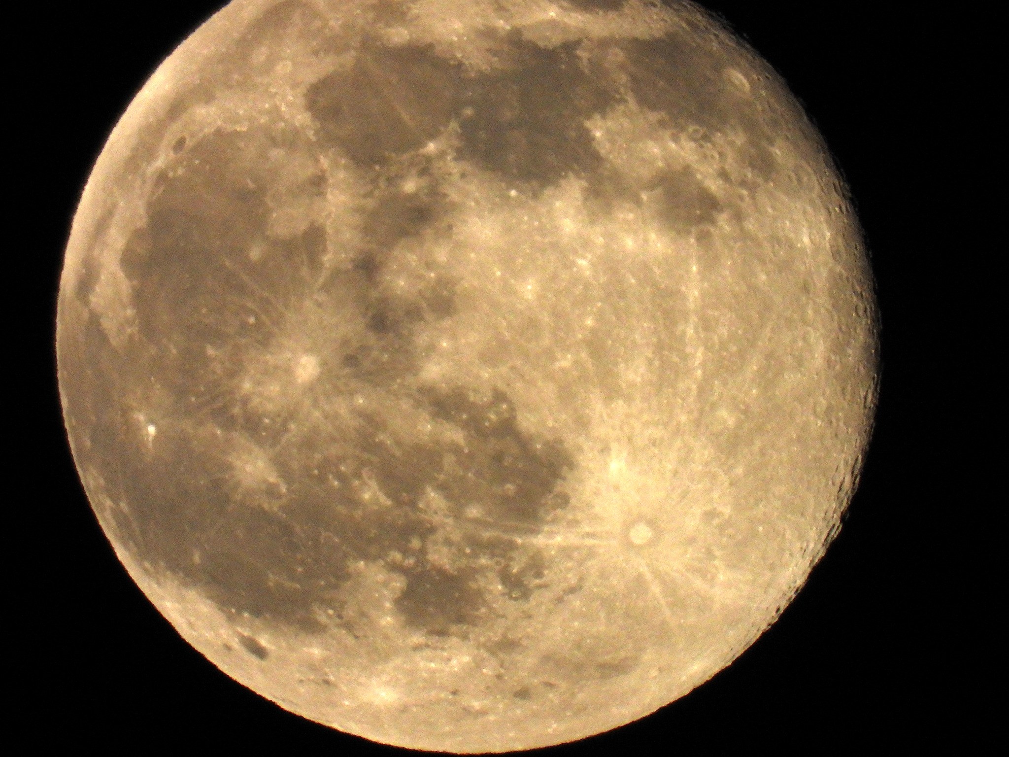
Moon
Last Quarter, 43% lit
Sun and moon times are calculated on our server for Brevard's beachside. Daily weather log, records and forecast →
Confirmed by: National Weather Service Melbourne, National Weather Service Melbourne, National Weather Service Melbourne
Updates
- At 7:56 a.m. the National Weather Service declared a Flash Flood Emergency for Palm Bay, Melbourne and West Melbourne until 9:45 a.m., saying 8 to 12 inches of rain had fallen and telling people there to move to higher ground now, according to the NWS warning. See our Flash Flood Emergency story. The northern Brevard warning for Titusville, Mims and Port St. John was extended until 10 a.m., per the extended warning.
- Headline updated to reflect National Weather Service radar estimates of 8 to 10 inches of rain in southeastern Brevard, per the extended Flash Flood Warning.
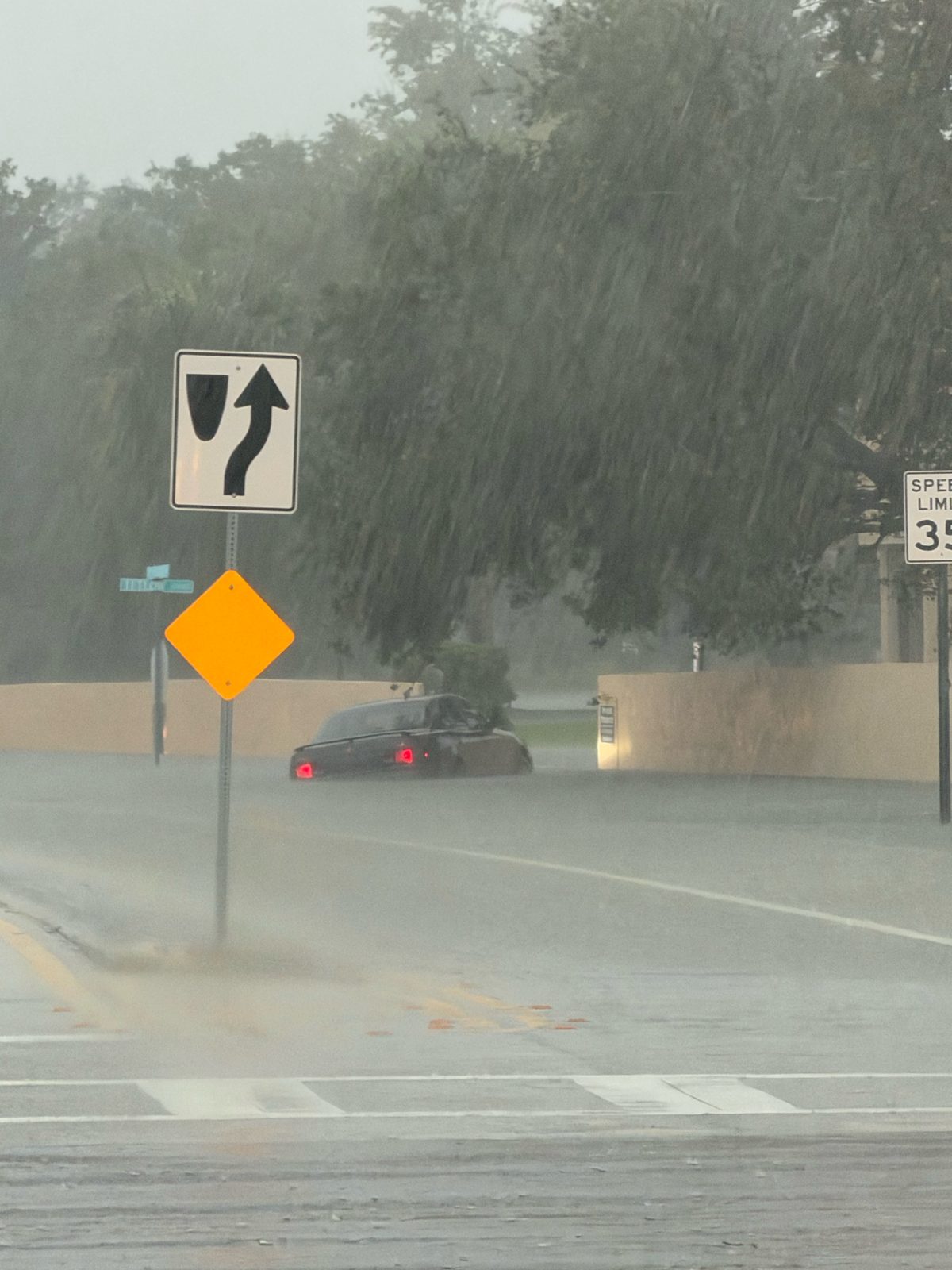
- The National Weather Service extended the Flash Flood Warning for southeastern Brevard, including Palm Bay, Melbourne, West Melbourne, Viera and the beachside, until 9:45 a.m. Radar showed 8 to 10 inches of rain had fallen there by 7:27 a.m., with 2 to 4 more inches possible, according to the extended warning. Brevard Emergency Management reported widespread road flooding, especially in the south end of the county, and asked people to stay home if they don't need to be on the roads.
The National Weather Service in Melbourne put much of Brevard County under Flash Flood Warnings early Monday as slow-moving bands of heavy rain kept building over the county overnight. The warning for southern and central Brevard, first issued at 4:44 a.m. (NWS post), was extended at 7:27 a.m. until 9:45 a.m., according to the extended warning. Radar showed 6 to 8 inches of rain had already fallen there, with 2 to 4 more inches possible, and the weather service describes the flooding as life-threatening for streets, highways, underpasses, creeks and low-lying areas.
Places named in that warning include Palm Bay, Melbourne, West Melbourne, Viera, Suntree, Rockledge, Merritt Island, Malabar, Grant-Valkaria, Micco, Barefoot Bay, Palm Shores, Patrick Space Force Base and the beachside from Satellite Beach and Indian Harbour Beach to Indialantic and Melbourne Beach, according to the NWS alert.
A second warning covers northern Brevard, including Titusville, Mims, Port St. John and Sharpes, until 8 a.m., according to the 4:58 a.m. warning. Radar there showed 2 to 4 inches had fallen, with 2 to 3 more inches possible. Earlier warnings overnight had covered West Melbourne and Viera and Palm Bay, Melbourne and Satellite Beach.
For the Monday morning commute, the weather service and Brevard Emergency Management urge drivers to turn around at flooded roads rather than drive through them, since most flood deaths happen in vehicles. The county-wide Flood Watch stays in effect until 7 p.m. Monday; see our Flood Watch story for the background.
Conditions change quickly. Check NWS Melbourne for the latest alerts, and see the weather service's flood safety tips.
Sources
- NWS Melbourne Flash Flood Warning extension, southeastern Brevard (API), Nov. 2, 2026, 7:27 a.m. api.weather.gov/alerts/urn:oid:2.49.0.1.840.0.d83959fc894eebd366896411622bbbd63798937b.001.1
- Brevard EOC on X: widespread road flooding, 7 a.m. x.com/BrevardEOC/status/2117227744383713282
- NWS Melbourne Flash Flood Warning, southern Brevard (API), Nov. 2, 2026, 4:44 a.m. api.weather.gov/alerts/urn:oid:2.49.0.1.840.0.9756dd78c7a7ff7e4cb7e5720c794306496e71b2.001.1
Show all 12 sourcesShow fewer
- NWS Melbourne Flash Flood Warning, northern Brevard (API), Nov. 2, 2026, 4:58 a.m. api.weather.gov/alerts/urn:oid:2.49.0.1.840.0.1cf60d48e0fef55f73f0aa096694ed99434b54df.001.1
- NWS Melbourne on X: Flash Flood Warning, 4:45 a.m. x.com/NWSMelbourne/status/2117191924130140287
- NWS Melbourne on X: Flash Flood Warning, 5:15 a.m. x.com/NWSMelbourne/status/2117199208835170661
- NWS Melbourne on X: earlier warning for West Melbourne and Viera x.com/NWSMelbourne/status/2117156990049034464
- NWS Melbourne on X: earlier warning for Palm Bay, Melbourne and Satellite Beach x.com/NWSMelbourne/status/2117174742075523301
- Brevard EOC on X: commute flooding reminder x.com/BrevardEOC/status/2117195300896923879
- NWS Melbourne Flood Watch extension (API) api.weather.gov/alerts/urn:oid:2.49.0.1.840.0.c2c270961ae506c66262159e4946611664f737ea.001.1
- NWS flood safety www.weather.gov/safety/flood
- NWS Melbourne www.weather.gov/mlb/
Spot something wrong? Request a correction · Our standards
Comments
Keep it friendly. Rude, hostile or personal-attack comments will be removed.